New article: spatial mapping of abandoned mines and land use
We are pleased to share that our team member, Dr. Mika Siljander, has co-authored a new peer-reviewed study titled “Spatial Mapping of Abandoned Mines and Land Use–Land Cover Changes in Kamtonga and Mkuki of Kenya: A Remote Sensing and GIS Approach”, published in the Journal of Geography, Environment and Earth Science International.
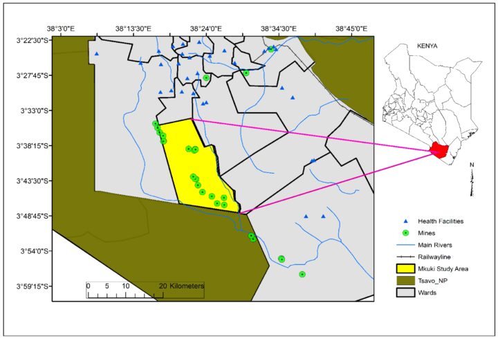
The study uses Geographic Information System (GIS) and remote sensing techniques to investigate land use–land cover (LULC) changes in the Kamtonga and Mkuki regions of Kenya. Through detailed spatial analysis of abandoned mines and their environmental impacts, the research highlights the consequences of mining activities and offers a critical foundation for policymakers and institutions to design and implement effective mine rehabilitation strategies.
Dr. Siljander’s expertise in geoinformatics was central to the development and application of the spatial analysis techniques in the study. This work marks another successful collaboration with MSc students and researchers from Taita Taveta University, Kenya, and underscores the importance of international partnerships in addressing global environmental challenges.
The full article is available open access: 10.9734/jgeesi/2025/v29i4889.