From numbers in a table to robots in the field
In machine learning, success often means a better number in a results table. But what happens when that model has to work on a drone above a river, or on a robot in a forest with no internet connection? In this blog, I share how my UTU-GreDiT doctoral research in robotics took me from datasets and benchmarks to four field campaigns across Finland, and what the real world has taught me about artificial intelligence.
Where I started: a world of tables
Before joining UTU-GreDiT, my world was machine learning and image processing. I trained models, tested them on well-known datasets and compared them in tables. If my method scored a little higher than the one before, that was progress.
I enjoyed that world, and I still do. But one question kept bothering me: what happens to all of this outside the lab? A model that recognises objects perfectly in a curated dataset may struggle with glare on water, falling light or a camera shaking on a moving robot. Papers are full of impressive numbers, but far fewer show those methods working on real machines in real places.
That question is what brought me to the Turku Intelligent Embedded and Robotics Systems (TIERS) lab at the University of Turku. I wanted to take what I knew about AI and computer vision and see whether it could survive contact with the real world.
What I work on
My PhD project is about robot teams that monitor natural environments. The idea is to combine drones, which see the big picture from above, with ground and surface vehicles, which can work for hours close to the ground or the water and see details the drone misses. Together they could keep watch over changing environments, such as eroding riverbanks or shifting shorelines, places that are slow, costly and sometimes dangerous for people to survey by hand.
A key part of my work is giving these robots a better understanding of what they see, using vision-language models. These are AI models that connect images with words. They could let people give robots instructions in everyday language, and help robots make sense of situations no one planned for. And because remote rivers and coasts often have no internet, this AI has to run on small computers carried by the robots themselves.
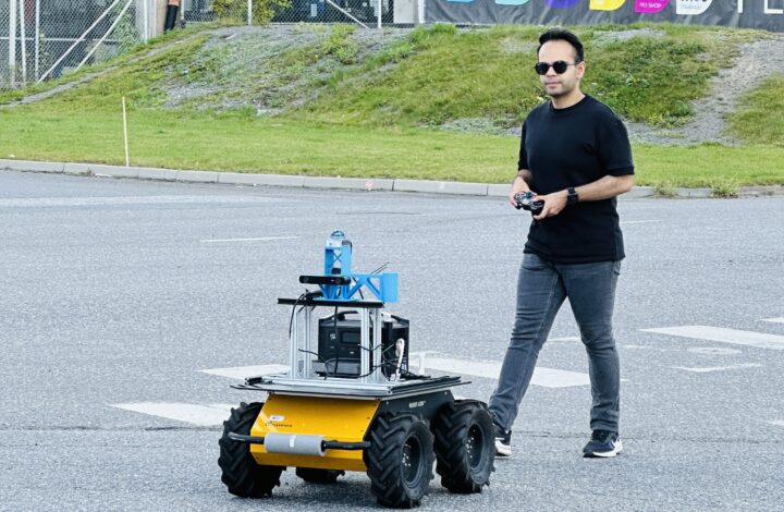
My first project was a step in this direction. Building on an existing robot navigation method, I replaced its cloud-based AI with compact language and vision-language models running on a small computer on board the robot. The result is a four-wheeled ground robot that can follow instructions like “go to the bench, but stay off the grass” entirely offline. It works out which landmark to head for, what to avoid and how to behave along the way, then finds the target with its camera and laser scanner and drives there, without ever sending a request to the cloud. It showed me that this kind of AI can work on a real robot, not just in a results table.
The full robot team is still an ambitious goal. The only way to get there is to go outside and test, again and again.
Four trips into the field
Since I joined, I have taken part in four field campaigns to collect data and run experiments. Each one taught me something that no table of results ever could.
Salo: the first time outside. Our first trip took us to the Uskelanjoki river near Salo. We brought a drone and a four-legged walking robot to test them by the river and collect our first data. It was more of a practice run, a warm-up for the bigger campaigns ahead. Even so, it was the first time I saw how different a real environment is from a dataset. We came home with two important lessons. First, when you record with several sensors at once, they have to be synchronised very precisely, or the data won’t line up. Second, communication between the robots needs just as much attention as the robots themselves.
The Aura river: making maps fast. Twice, we went to a site by the Aura river in Turku to collect drone data. The place has a bit of everything: water, paved paths, grass and a pedestrian bridge, but our focus was mainly on the river. The question was practical. Drones are now cheap and easy to buy, but turning their images into an accurate map usually needs expensive equipment, careful flight planning and hours of processing. Could we instead build a reliable map almost in real time, using an ordinary off-the-shelf drone?
It turned out we could. Together with colleagues from our group, and in collaboration with the Digital Waters (DIWA) flagship, we developed an approach that stitches the drone’s images into a seamless, map-accurate picture of the ground while the drone is still flying. We presented the work at an international drone mapping conference in Espoo. It was my first paper born from field work, and it showed me how much of the research happens before any algorithm runs: planning flights, checking positions, and dealing with the weather.
Oulankajoki: the big one. In September 2026 came our largest campaign so far, at the Oulankajoki river in northeastern Finland, just south of the Arctic Circle. Once again, we worked in collaboration with DIWA and its researchers, who study how Finnish rivers change and have followed this site for years. Working side by side with geography experts showed me what our robots can offer them, and what we still need to learn from people who know the environment deeply.
We brought a drone and a ground robot, both packed with cameras, laser scanners and precise satellite positioning. The site was chosen because it is hard for robots. Within a short walk there are open sand bars, dense forest where satellite signals weaken, and dark water that a laser scanner can barely see.
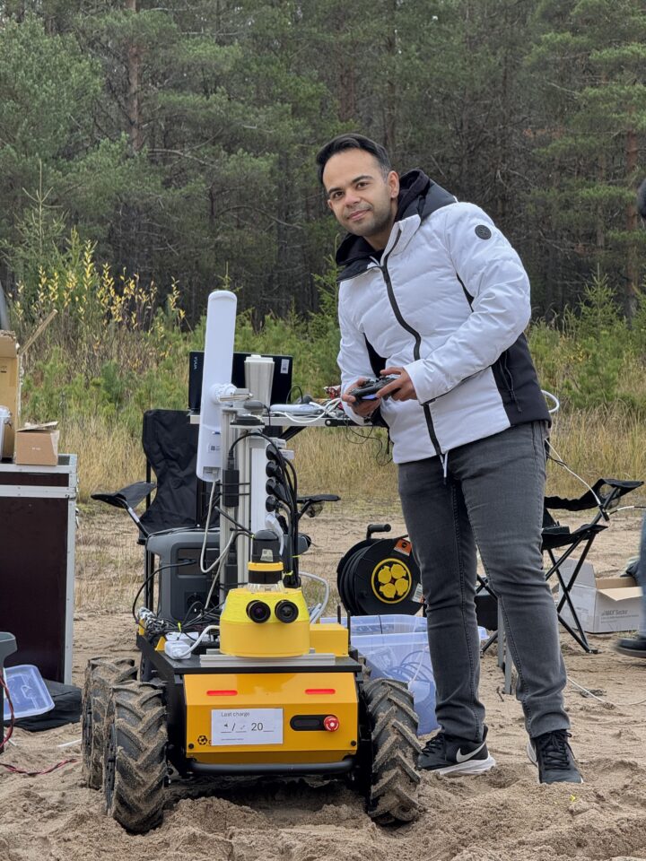
Getting the ground robot ready on a sand bar by the Oulankajoki river. (Photo: Ali Salmasi)
Our rule was simple: the field is for data only. Field days are short and precious, so we recorded everything from every sensor and saved the analysis for later. And of course, the field had its own plans. One recording didn’t close properly and had to be rescued. The position of our satellite base station was never saved, and I later dug it back out of the software logs. This far north, even the drone’s compass couldn’t be fully trusted. Solving these puzzles back home has taught me more about real robotics than any course.
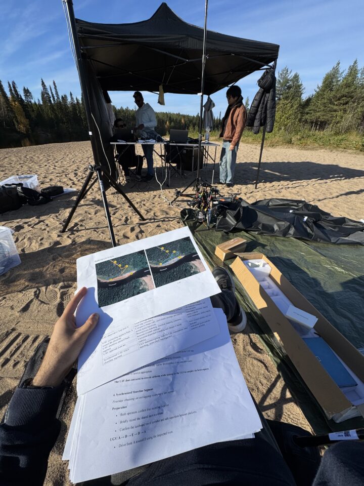
Our field base at the Oulankajoki river: mission plans in hand, the drone on the ground and the team checking the recordings. (Photo: Ali Salmasi)
As I write this blog, we are still processing and analysing the data, and I am excited to see what it will reveal.
What the real world taught me
Looking back at these trips, a few lessons stand out. None of them appeared in any paper I read before starting.
Preparation always takes longer than you think. The hours spent in the field are only the tip of the iceberg. Before every trip there are sensors to calibrate, clocks to synchronise, batteries to charge, software to test and equipment to pack, and every one of these steps takes longer than planned. I now plan generous time for preparation, and then add some more.
Something will always break. A cable comes loose, a sensor that worked perfectly yesterday stops sending data, a recording doesn’t save properly. A method that looks flawless in a results table suddenly has to cope with wind, glare and batteries that drain in the cold. The question is not whether something will go wrong, but how well you are prepared when it does.
Backups and redundancy save the day. Spare batteries, spare cables, a second copy of all the data every evening, and recording more sensors than you think you need. Each of these has rescued us at least once. When one piece fails, another can often fill the gap, and a day in the field that looked lost can still produce useful data.
Be ready to explain your work in simple words. A drone over a riverside path or a robot driving around a car park attracts attention. Passers-by stop, watch and ask what we are doing. Being able to explain it in a sentence or two, without jargon, turned out to be a real skill. These conversations are a good reminder of why the work matters, and great practice for writing a blog like this one.
Measure, don’t assume. We tested that first robot in the car park next to our office. To choose the AI that runs on it, I first used a large commercial AI model to grade smaller models. The results looked neat, until I realised they were biased towards models that “thought” like the grader. We went back to answers checked by humans. Since then, my rule is: AI output is a draft, never the ground truth. Field data takes this one step further: the real world itself becomes the referee.
Field work is teamwork. None of these campaigns would have worked without pilots, operators, planners and collaborators from other fields. Robotics is never a one-person job.
Learning and teaching
Learning hasn’t only happened in the field. In summer 2025, I joined the Multi-Robot Systems (MRS) summer school at the Czech Technical University in Prague, home to one of Europe’s best-known groups working on teams of drones. Spending time with students and researchers from many countries, all tackling the same hands-on robotics challenges, gave me new ideas and a network of people facing the same problems I do. The summer school ended with a team competition: using two drones, we had to visit a set of checkpoints on a given map. My team reached 18 of the 20 checkpoints. It wasn’t a perfect score, but the hands-on experience was worth every minute.
Alongside research, I have spent several semesters as a teaching assistant and supervised a master’s student, now graduated, whose thesis explored how robots can judge which terrain is safe to drive on. Explaining ideas to students forces you to understand them properly, and seeing a student grow into an independent researcher has been one of the most rewarding parts of my PhD so far.
Looking ahead
The next steps are about bringing the full robot team together: having ground and surface vehicles work alongside the drone, testing them again and again close to home, and moving from a few days in the field towards robots that can keep working for weeks with little human help.
When I started, success meant a better number in a table. Now it means a robot that does the right thing outside, in the cold, by a river or in a forest, with no one there to help it. That is a much harder test, and a much more interesting one.
Follow Ali on LinkedIn!
 Co-funded by the European Union. Views and opinions expressed are however those of the author(s) only and do not necessarily reflect those of the European Union or European Research Executive Agency (REA). Neither the European Union nor REA can be held responsible for them.