Beyond the Map: What Opportunities Can We Create for Youth?
Can a map do more than show where things are? My journey to UTU-GreDiT began with introducing university students in Tanzania to digital mapping tools. Today, that experience has grown into a broader research question: how can youth engagement, digital skills and geospatial data contribute to climate-resilient African cities while creating meaningful learning and future opportunities for young people?
It started with a map
Before my PhD studies, I had the chance to work with students during their fieldwork. One task was to identify local resources, institutions and boundaries and represent them on maps. At the time, much of this mapping was still manual. Students and community members could begin by drawing features on the ground and later transfer the information onto paper. With my geospatial background, I saw an opportunity to complement this process with digital mapping.
We began introducing students to GIS and smartphone-based data collection using tools such as ODK and KoboCollect. In the local community, the process remained collaborative: community members contributed their local knowledge, while students collected and organised information that could later be transformed into digital maps. For many students, this was their first encounter with GIS, mobile mapping and digital spatial data. Some described the experience as eye-opening and wished they had been introduced to these tools earlier.
What stayed with me most was not only the maps we produced, but the students’ response and excitement at the opportunity to use the technology. I began to realise that access to digital tools is not simply about technology. It is also about opportunity.
At the same time, I saw that those opportunities were not equal. Students came with different levels of digital experience, and some lacked access to smartphones or basic computer skills. Those experiences left me with questions that went beyond mapping: What do young people actually gain from participating in digital activities? What happens to those skills afterwards? And how can such opportunities become more inclusive and connected to real challenges in their communities?
When experience met opportunity
Years later, when I came across the UTU-GreDiT PhD opportunity, its title immediately caught my attention: “Open data, digital tools and youth engagement in digital public works for green transition and climate resilience in Africa.”
The project brought together themes I had already encountered through my work: youth engagement, digital skills, open data, climate resilience and the possibility of learning through real-world activities. It also emphasised developing new ways to engage young people, especially young women, and connecting skills development with future opportunities.
For me, applying for the post felt less like a change in direction and more like the next step. The community mapping experience showed me what can happen when young people are given the opportunity to use digital tools. The PhD gave me a chance to investigate those questions systematically and in a much wider urban and climate-resilience context.
What happens after the training ends?
My research is closely connected to the Tanzania Resilience Academy model, which brings together universities, young people, communities and other partners to address urban resilience challenges using open geospatial data and digital technologies. At the heart of the model is learning through practice: students develop digital and geospatial skills while working on real data needs and climate-related challenges in Tanzanian cities.
The Resilience Academy provides an important foundation for my research. I want to learn from it, and from similar youth-focused geospatial initiatives that have already achieved this, while also looking beyond participation itself. What happens after the training or mapping campaign ends? Do young people continue using the skills they gained? Do these experiences lead to further learning, professional networks, new projects or employment? And what helps or prevents these benefits from lasting?
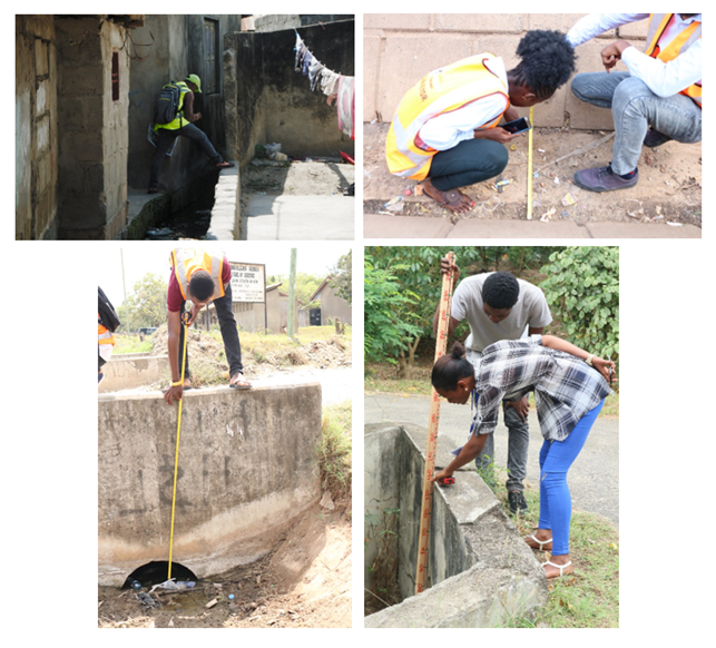
Students mapping drainage during different community mapping activities in Tanzania (source: Resilience Academy)
One part of my research therefore follows former participants’ experiences and draws on project coordinators’ perspectives. I am interested in the skills and confidence young people gained, how they have used them afterwards, the opportunities that followed and the challenges they encountered. I also want to understand how experiences and outcomes may differ among participants, including between young women and men, and whether programmes generate benefits that were not originally anticipated.
This matters because the success of a youth programme cannot be understood simply by counting how many young people were trained or how much data they collected. We also need to understand what lasts beyond the programme and what conditions can turn a short-term learning experience into skills, connections and opportunities that young people can carry forward.
My research also looks ahead by exploring a training-plus-practice approach, where young people develop digital and geospatial skills while applying them to real urban climate challenges. Instead of learning a mapping tool only through classroom exercises, participants can use it to collect and analyse information that has practical relevance for their cities. My current plan includes participatory mapping of urban trees and green spaces, alongside geospatial analysis of climate-related challenges such as flood exposure.
For example, information about the location and characteristics of urban trees can help us understand the distribution of green infrastructure and where nature-based solutions could potentially support urban climate resilience. This is where the different parts of my research come together. Youth participation can generate useful information for understanding urban climate challenges while also creating opportunities for practical learning and skills development.
The PhD journey behind the research
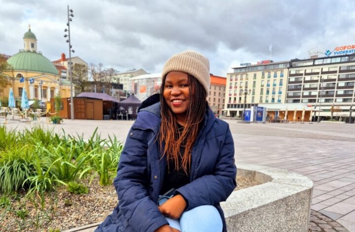
Of course, developing this research has also meant developing as a researcher. The opportunity brought me from Tanzania to Finland, which meant adapting to a new academic environment, culture and, perhaps most noticeably, a very different climate. Learning to live through the Finnish winter has been an experience in itself, especially coming from a much warmer part of the world.
Beyond adjusting to life in Finland, I have also had to adjust to the demands of doctoral research. One thing I have particularly valued is my supervisors’ guidance. Their feedback has challenged me to think more critically, sharpen my research questions and sometimes rethink ideas that initially seemed perfectly clear in my head.
I have also learned that research is rarely an individual journey. Being part of UTU-GreDiT means working alongside researchers from different disciplines and backgrounds. Discussions with colleagues, supervisors and project partners continually remind me that the questions I am studying cannot be understood from a geospatial perspective alone. Youth engagement also requires thinking about learning, employment, gender, institutions and the social context in which technology is used.
Another important part of this journey has been the opportunity to undertake a secondment to the Global Facility for Disaster Reduction and Recovery (GFDRR) at the World Bank Group’s Nairobi office. This experience has allowed me to see more closely how geospatial information, Earth Observation, and digital approaches are applied to real urban development and resilience challenges. It connects strongly with my PhD interests in digital public works, youth engagement and the use of geospatial technologies for urban climate resilience.
For me, the secondment provides an important bridge between research and practice. It has given me opportunities to engage with people working on operational urban challenges and to reflect on how the questions I am exploring through my PhD can connect with the needs of cities and development organisations. It has also reinforced the importance of collaboration between universities, young people, governments and development partners.
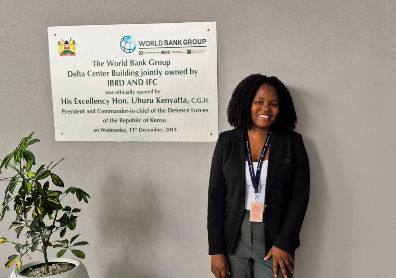
My secondment at the World Bank Group, Nairobi office
The Challenges Along the Way
One part of the PhD that I underestimated was how challenging publishing can be. Turning months of work into a paper, receiving comments, revising arguments and sometimes revising them again has taught me a lot about patience. I am learning that doing research is only part of the job; communicating clearly why it matters is another.
Despite the challenges, the experience so far has helped me grow both professionally and personally. I came to Finland with experience in GIS and working with young people, but the PhD is pushing me to think more deeply about research design, collaboration, youth engagement and how research can connect with practice.
Looking forward
The next stage of this journey is the one I am particularly excited about: moving from learning from previous initiatives to testing and refining these ideas through my own research.
I look forward to working with young people through participatory geospatial activities and continuing to collaborate with the Resilience Academy and other partners. I am curious to see whether the patterns emerging from previous initiatives also appear in new activities, and what surprises the research may bring.
Ultimately, I hope to bring these different parts together into practical lessons about how universities, cities and other organisations can design youth-focused digital initiatives that are inclusive, connected to real urban challenges and capable of creating value beyond the life of a project.
There is still plenty ahead: fieldwork, data analysis, papers to write and, undoubtedly, more reviewer comments. But there are also opportunities to learn, collaborate and see where the questions that first emerged during community mapping in Tanzania eventually lead.
Beyond the map
Looking back, it is interesting that this journey began with something as simple as wanting to improve how community maps were produced.
At first, I was thinking about the map: Could it be more accurate? Could information be collected digitally? Could GIS make local resources easier to visualise?
Over time, my attention shifted from the map to the people making it.
Today, through UTU-GreDiT, those early observations have grown into research about what happens before, during and after young people participate in digital and geospatial initiatives. I want to understand how they learn, what opportunities may follow, who gets included, and how their contribution can also support climate-resilience knowledge in African cities.
Today, I still love maps.
But the question that interests me most is no longer simply: What can we map?
It is: What opportunities can we create for the young people behind those maps?
That question continues to guide my research at UTU-GreDiT.
Follow Monica on LinkedIn!
 Co-funded by the European Union. Views and opinions expressed are however those of the author(s) only and do not necessarily reflect those of the European Union or European Research Executive Agency (REA). Neither the European Union nor REA can be held responsible for them.