Hot off the press! Vegetation maps for the Juruá river area
A paper titled Revealing floristic variation and map uncertainties for different plant groups in western Amazonia is just out and open access in Journal of Vegetation Science!
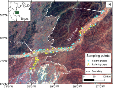
The field data was collected in a expedition led by Prof. Hanna Tuomisto along Juruá River that included researchers from Aarhus University (DK), the National Institute of Amazonian Research in Manaus (BR) and members of the Amazon Team of University of Turku.
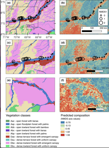
Now, and as part of the project in “Amazonian biogeography: remote sensing in Amazonia“, led by Prof. Henrik Baslev, the postdoc researcher Gabriela Zuquim and collaborators have combined the floristic data obtained in the field with remote sensing predictors to map the vegetation in the area.
According to the authors, the resulting “maps provide geoecological characterization of the regions and can be used to test biogeographical hypotheses, develop species distribution models and, ultimately, aid science-based conservation and land-use planning.”
Congratulations to all authors!
Read more: