Paper out! Species distribution models and remote sensing data
Congratulations Jasper et al. for the published paper!
Multispectral canopy reflectance improves spatial distribution models of Amazonian understory species
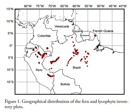
The article is about the distribution of Amazonian plants. By using satellite images, we can better estimate where species can (or cannot) grow in vast Amazonian forest.
This means that freely available, global remote sensing data can aid conservation planning, biodiversity management and biogeographical studies.
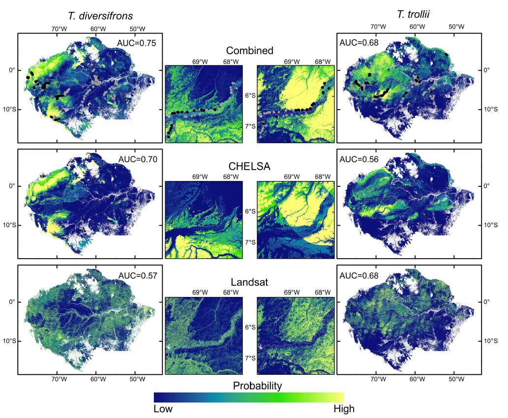
“Our results show that canopy surface reflectance obtained by multispectral sensors can provide studies of tropical ecology, as exemplified by SDMs, much higher thematic (taxonomic) detail than is generally assumed. Furthermore, multispectral datasets complement the traditionally used climatic layers in analyses requiring information on environmental site conditions.”
OPEN ACCESS! click the link to read more
https://onlinelibrary.wiley.com/doi/full/10.1111/ecog.04729