Using remote sensing to map tree species distributions and communities in Amazonia
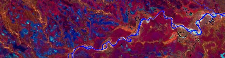
Amazonia, the largest and most diverse tropical forest in the world, continues facing pressures and losing forest cover while vast areas remain biologically poorly known. Knowing where a species occurs, and the distribution of biologically unique areas is key in conservation and natural resource management. Collecting biological information is a basic requirement for determining such biologically important areas but it is time-consuming and expensive, especially in tropical and remote areas such as Peruvian Amazonia.
Pablo Pérez Chaves combined three things in his doctoral research in order to map biodiversity patterns in Peruvian Amazonia: forest inventory data, satellite images and machine learning algorithms.
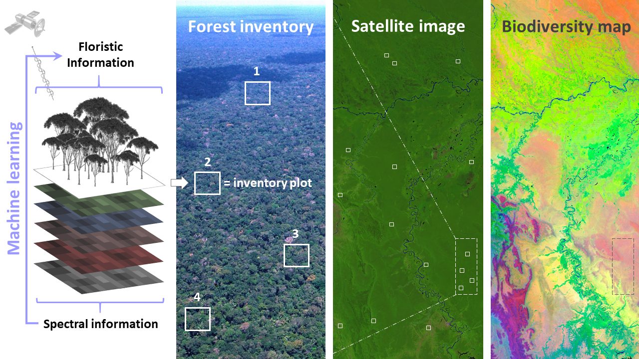
Tree inventory field data was accessed from forestry concessions in Peruvian Amazonia and from the Peruvian National Forest Institute (SERFOR). Remote sensing data, such as Landsat satellite data and digital elevation models, provide continuous information over large extents that is useful for biodiversity assessments. Machine learning was used to predict the biodiversity information from the field data, based on the remote sensing data. By combining those three things it was possible to model the distribution of trees at local extents and to predict floristic patterns of trees at broader extents. Ultimately, he published the first map of floristic patterns of trees in Peruvian Amazonia.
The combination of forest inventory data with available remote sensing layers offers an efficient way of mapping continuous biodiversity patterns, such as tree species distributions and tree community composition, in a still poorly known region like Peruvian Amazonia.
“This research has practical implications for characterizing biodiversity patterns in areas where field data is still missing and for identifying suitable areas for forest management and conservation purposes. This framework and research provide key information for decision-makers and can be replicated in other parts of the world”, mentioned Pablo.
He was also runner-up in the 3 minute thesis (3MT) competition at the University of Turku in 2018 with this presentation “Mapping Amazonia Using Machine Learning and Satellite Imagery” and won not only the local but international SANORD 3MT competition in 2020, with this presentation “Mapping floristic patterns in Amazonia”.
Pablo Pérez recently defended his doctoral dissertation and his doctoral thesis was accepted with honours. Below you can see a video of his research in Spanish with subtitles in Finnish.