GreenPlace seminar in June 2022 offered inspiration for future work
Nora Fagerholm, Department of Geography and Geology, University of Turku
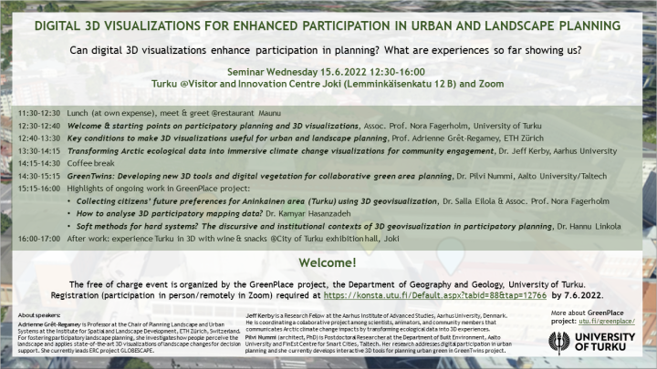
GreenPlace project organised a seminar in Turku and online on June 15, 2022. The topic of the seminar was Digital 3D visualisations for enhanced participation in urban and landscape planning. We were excited to have three interesting guest speakers joining us. The seminar started by Prof. Adrienne Grêt Regamey’s (ETH Zürich) presentation with the framing of six key conditions to make 3D visualisations useful for urban and landscape planning. These ranged from the creation of informed designs to the integration of active sensing. Prof. Grêt Regamey also highlighted existing challenges in the field such as accessibility of data and the need to build a community of practice for sharing good experiences around the application of 3D visualisations for communicative planning.
Next, Dr. Jeff Kerby (Aarhus University) talked about how to transform Arctic ecological data into immersive climate change visualisations to enhance community engagement. He presented a case from the remote Qikiqtaruk Territorial Park, Alaska and asked how to communicate environmental change beyond the human perceptual scale through virtual landscape experiences.
The third invited speaker Dr. Pilvi Nummi (Aalto University & Taltech) presented ongoing research on the GreenTwins 3D tool that aims to work as a platform for collaborative green area planning. With a specific focus on presenting green elements in 3D, the tool is meant to advance this particular field in 3D visualization. To date, it has been tested successfully with urban planners and citizens in Helsinki and Tallinn and further developed based on the needs of these two user groups.
Finally, researchers of GreenPlace project gave highlights of their ongoing work. Dr. Salla Eilola presented the piloting of a 3D PPGIS tool. The tool has been co-developed with companies Mapita and Sova3D and the city of Turku in order to gather future preferences of Turku citizens for the development of Aninkainen area in Turku. Dr. Kamyar Hasanzadeh deepened the topic by presenting the analysis methods for 3D PPGIS data collected in the pilot case. The seminar was concluded by Dr. Hannu Linkola discussing the discursive and institutional contexts of 3D visualization in participatory planning and the actualization of soft participation using hard technological solutions.
All in all, the seminar offered a wide range of topics and provided inspiration for future work. Discussion was also lively among the around 35 on-site and online participants. GreenPlace project members identified following key messages from the seminar:
- Overall, the field of 3D visualization is gaining maturity in communicative planning applications.
- Interdisciplinary collaboration is a requirement to develop 3D visualisations for participatory urban and landscape planning purposes.
- Academics have an important role in building common conceptual groundin the heterogenous field.
- Communication through 3D visualisations in landscape and urban planning has often been realized as collaboration that brings a group of people to discuss, rather than targeting for wide participation of people. These two approaches serve different purposes in planning processes or for sharing information.
- Participatory or collaborative efforts and usability evaluation of 3D visualisations should aim to engage a wide range of user groups.