Research
Our key research areas are:
- Participatory mapping approaches (Public Participation GIS (PPGIS), Participatory GIS (PGIS)) in landscape value and ecosystem service mapping
- Landscape, land cover and forest change analyses through remote sensing and geographical information systems (GIS)
- Human-nature relations and wellbeing benefits of urban green infrastructure
- Multispecies justice
- Participatory land use planning
- Integrated coastal zone planning
- Application of 3D virtual landscape in participatory planning
- Environmental change, climate change, resilience
- Community-based natural resource management and food security
- Geospatial capacities in Higher Education Institutions
- Geospatial business development
We provide research-based landscape education in the following courses at UTU:
- MAAN7772 GeoAI and Participatory Mapping for Sustainability Transformations, 10 ECTS
More information on geospatial skills development through UTU Geospatial Labs https://geospatial.utu.fi/
Projects
Ongoing research Projects
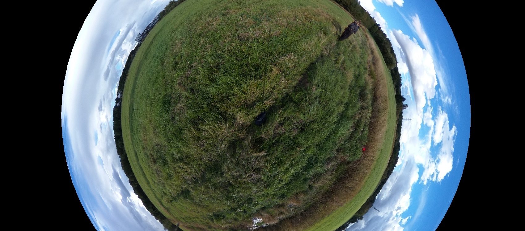
LostToClimate (2025-28)
![]()
Addressing Unavoidable Non-Economic Losses to Climate-Induced Events for Communities in the Arctic
The Arctic faces rapid warming, causing permafrost thaw, wildfires, sea-ice loss, and coastal erosion, which harm communities economically (e.g., infrastructure damage) and non-economically (e.g., cultural loss, mental health impacts). Non-economic losses and damages are often overlooked in policy, despite their significant effects. While adaptation can help mitigate these impacts, there are limits to its cost-effectiveness, requiring careful, socially just decision-making. The LostToClimate project funded by NordForsk (grant agreement no. 213038) addresses these challenges by uniting scientists and Arctic communities, including Indigenous groups, across eight countries. Through ethnographic and art-based methods, it fosters equal collaboration to better understand and reduce non-economic losses while supporting resilient, just outcomes.
Website: https://www.losttoclimate.org/
Contact: Associate Professor Nora Fagerholm
JUST TREES (2025-27)
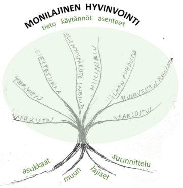
Multispecies well-being and accessibility of urban nature in densifying cities
JUST TREES, funded by the Turku Urban Research Program, investigates the sufficiency, accessibility, and equitable distribution of urban nature in densely populated residential areas from the perspective of multispecies well-being. This concept aims to design living environments considering the needs of both humans and other species. Project aims to 1) enhance understanding of the well-being benefits provided by greenery for both humans and other species, and 2) provide information and guidance to support the well-being, climate, and biodiversity benefits of urban nature, particularly trees. The project applies the 3-30-300 rule, which states that everyone should see three trees from their home, neighborhoods should have 30% tree canopy cover, and everyone should have access to a green space within 300 meters.
Website: https://sites.utu.fi/justtrees/
Contact: Associate Professor Nora Fagerholm

Urban Biodiversity Parks (2024-27)
Co-creative platforms for enhancing biodiversity, learning and community involvement in urban ecological regeneration
There is an urgent need to find new ways for active enhancement and regeneration of biodiversity in lost or degraded urban habitats – in addition to traditional nature conservation measures. Funded by European Urban Initiative, the Urban Biodiversity Parks project will develop a full-scale biodiversity park of about 20 ha in the Turku city district of Skanssi. The park will enhance biodiversity in various habitats and protect local and endangered species. Additionally, small-scale biodiversity pilots will be implemented in selected suburban neighborhoods, which enables participants to co-learn how urban restoration solutions can be integrated in suburban planning, development and regeneration.
Website: Urban Biodiversity Parks
Contact: Associate Professor Nora Fagerholm
MUST (2023-2026)
Multispecies transitions of cities and regions
Biodiverse and functional ecosystems are rapidly deteriorating worldwide because economic and planning decisions see nature as a resource, framing it as a source of capital aims to enhance understanding about the types of relationships between humans and other species that could produce and sustain ecologically and socially just outcomes. MUST project funded by the the Strategic Research Council operating under the Research Council of Finland (grant no. 358368) aims to build social-ecological resilience in urban and regional areas by rethinking nature-based solutions processes, structures and practices from the perspectives of both humans and other species.
Website: https://must-project.fi/
Contact: Associate Professor Nora Fagerholm
RESIST (2023-2027)
Regions for climate change resilience through Innovation, Science and Technology
Website: https://resist-project.eu/
Contact: Associate Professor Nora Fagerholm
Transformative cities (2023-2025)
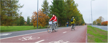
Transformative Cities: Coupling citizen-inspired geospatial and transformative governance methods to promote carbon neutral and climate resilient cities by 2035
To enable rapid transformations towards carbon neutrality and climate resilience in urban areas of Finland, a much deeper understanding is needed about how people actually live in urban settings and how this local knowledge can be combined with urban policy, law and planning practice. Transformative Cities aims to create an integrated set of mobility modelling, participatory mapping and governance methods for enabling sustainable urban lifestyles. This includes transport mode shifts from car use to more sustainable transportation options (e.g., e-bikes, active mobility, shared transport) in ways that promote healthy environmental exposures through nature-based solutions (NBS). We use these combined methods in order to assess opportunities and constraints to transformation to carbon neutrality and climate resilience in cities by 2035, and to co-create planning practices, policy options and business strategies to promote behaviours in support of sustainable urban lifestyles. Transformative Cities has received funding from the European Union – NextGenerationEU instrument and is funded by the Academy of Finland under grant number No 352943.
Website: https://transformative-cities.eu/project/
Contact: Associate Professor Nora Fagerholm
KADI (2022-2025)
Knowledge and climate services from an African observation and Data research Infrastructure
KADI is an interdisciplinary African-European cooperation project designing and piloting comprehensive science-based concepts for atmospheric and climate service infrastructures on the African continent. The climate service infrastructures aim to sharpen the common action on climate change and its impacts by acknowledging societal demands and expectations of climate observation systems for sustainable implementation. The project duration is from 2022 to 2025, and it is funded by the European Union and coordinated by Integrated Carbon Observation System (ICOS). UTU Geography department leads one work package, and one task in the project. The research work contains assessments of current state of climate service infrastructures and needs for them in Africa, as well as piloting an urban climate service in Dar es Salaam in collaboration with our long-term institutional partner, Ardhi university (ARU).
Website: https://www.icos-cp.eu/event/1276
Contact: Professor Niina Käyhkö
Past research Projects
Charter (2020-2024)
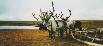
Drivers and Feedbacks of Changes in Arctic Terrestrial Biodiversity
CHARTER is an ambitious effort to advance the adaptive capacity of Arctic communities to climatic and biodiversity changes through state-of-the-art synthesis of scientific knowledge and co-creation with the communities. The project combines expertise from Earth System sciences and biodiversity studies within a social-ecological system (SES) framework and works with communities to make the science relevant to their adaptation efforts. . The role of UTU is to study perceived environmental changes and future landscape preferences among Arctic communities under the work package 3 of the project. This entails conducting an online map-based survey in two communities in Finland and Sweden. CHARTER is a four-year research project funded by the European Union Horizon 2020 program.
Website: https://www.charter-arctic.org/
Contact: Associate Professor Nora Fagerholm, Postdoctoral Researcher Salla Eilola
Intestour (2022-2024)
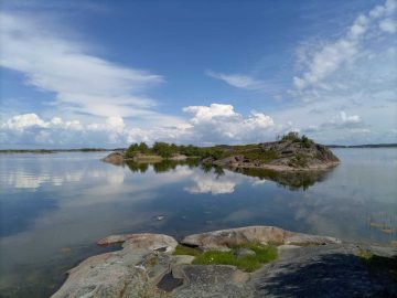
Interdisciplinary analysis of ecological and social complex feedbacks and relations linked to coastal tourism: the case of the Archipelago Sea Biosphere Reserve
In recent years, several Biosphere Reserves have become important tourist destinations, especially those in industrialized countries. Tourism results in multiple both negative and positive impacts in coastal environments. Tourism is an economic activity, but also an anthropogenic driver that consumes resources and has multiple environmental and social impacts. As such, tourism and the ecosystem services that support it are affected by multiple drivers that impact coastal areas. Thence, tourism activities and the ecosystem services that support them receive the impacts of anthropogenic drivers. This project aims to study the social and ecological complex feedbacks and relations linked to tourism in the Archipelago Sea Biosphere Reserve (Finland) to provide holistic and interdisciplinary knowledge for the Archipelago Sea management. INTESTOUR is a three year research project funded by Margarita Salas funding.
Contact: Postdoctoral Researcher Liliana Solé Figueras
Green Place (2019-2024)
Wellbeing benefits of urban green infrastructure mapped through participation and 3D virtual landscapes
Increasing urban population creates pressure to densify the urban structure but at the same time to stay liveable by sustaining urban nature and green infrastructure. It is of outmost importance for urban planners to know in detail where the green areas and elements contributing to people’s wellbeing (i.e. ecosystem services) are located. GreenPlace project aims to develop and test 3D landscape platform that enable mapping place-based perceptions of urban dwellers in a new way. The essential innovation of this research is to integrate 3D virtual landscapes with map-based web survey (Public Participation GIS, PPGIS) which creates a unique platform for capturing place-based perceptions. Methods are also developed for analysing 3D PPGIS data. Also, evaluation of the potential and challenges of 3D PPGIS approaches in participatory spatial planning is performed. GreenPlace is a five-year research project funded by the Academy of Finland (Academy Research Fellow, grant number 321555).
Website: https://sites.utu.fi/greenplace/
Contact: Associate Professor Nora Fagerholm
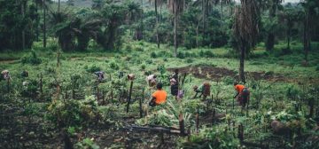 SUSLAND (2014-2018)
Sustainability, scale relations and structure-function-benefit chains in the landscape systems of the Tanzanian Southern Highlands
SUSLAND research project studied the rapid land use changes in Tanzanian Southern Highlands, where loss of forest and natural vegetation occur due to poverty, population growth, settlement expansion, agriculture, and overuse of forest resources. By utilizing land transition and socio-ecological system theories, and spatially explicit data under the Ecosystem/Landscape Service framework, the project researched the sustainability, scale relations, and structure-function-benefit chains within the landscape systems of the area. Through participatory GIS methods, Earth Observation, geospatial analysis, and PLA techniques the project explored what type of interactions and trade-offs exist between the material realities such as land resources and biodiversity, and human values and benefits. The research enhanced understanding of landscape assets, conservation potential, and proposed best practices for participatory land use planning and natural resource management. Additionally, the project’s goal was to increase the skills and knowledge of Tanzanian stakeholders in geospatial information applications, participatory land mapping, monitoring, and management, contributing to scientifically-based and socially acceptable future planning practices.
Contact: Professor Niina Käyhkö
Doctoral Research Projects
MSc. Luma Fonseca: Co-designing urban nature-based solutions using digital participatory tools
The research aims to harness the potential of digital tools to collaborative design urban Nature Based Solutions (NBS) scenarios, enabling stakeholders to assess and develop scenarios within innovative digital environments, while engaging stakeholders in reflecting upon the impacts of their design decisions. This research will help to bridge the often technocratic process of urban NBS planning with a more accessible, collaborative and co-creative methodology, fostering informed and inclusive sustainable urban systems.
MA Akseli Tolvi: GeoAI and Participatory Methods in Holistic and Sustainable Management of Cultural Heritage
Cultural heritage is a part of our everyday lives and an important building block of our identities. Cultural values and significance exist in all aspects of a landscape resulting from interaction between people and places, but current management is still largely focused on protection of specific sites and monuments. In my PhD research, I aim to develop innovative methodological practices for holistic, landscape level management of cultural heritage. My research approaches this subject from landscape ecology perspective and will make use of GeoAI and Participatory GIS methods. My empirical case studies take place in Flanders, Belgium and Eastern Africa. My goal is to develop methodology that can be operationalized in a wide variety of landscapes and empowers the heritage communities to participate in the management of their own heritage.
MSc Harri Aaltonen: Experientiality of mobility spaces in urban areas
In my PhD research I focus on people’s experiences of mobility spaces in urban areas, largely putting emphasis on what kind of affordances people perceive in these environments while travelling. Affordances are relationships between an agent and properties of an object, in this case between travelling people and properties of surrounding space. Mobility brings in aspects of chosen transport mode and mobility behavior, both which along with the surrounding space, create a framework for the experience of mobility spaces. I use GEMA-based (Geographically explicit Ecological Momentary Assessment) methods that allow day-to-day participant-initiated data collection on individual’s interaction with their environment in terms of their everyday spaces.
MSc Venla Aaltonen: Climate risks in urban socio-ecological systems of Africa – Role of novel integrated geospatial and community-based approaches
My PhD research concentrates on building holistic and spatio-temporal understanding of the complex interconnectedness of urban socio-ecological systems and the key drivers that cause and exacerbate climate vulnerabilities in Africa. I am using multifaceted geospatial data and systemic science approaches that are tied to the local contexts’ characteristics, such as quality of urban greenery, type of infrastructure, and the experiences of the citizens. My research also highlights the role of local knowledge, citizen science and other bottom-up methods that are essential in producing academic knowledge with transformative potential. Thus, the main objective of my research is to develop novel integrated methods – Geospatial and Earth Observation methods combined with community-based methods, such as place-based participatory and volunteer mapping – to advance scientific knowledge of the complex and interconnected vulnerability in the socio-ecological systems of urban Africa. The first theses of my research are closely tied to the activities of KADI (Knowledge and climate services from an African observation and Data research Infrastructure) project.
MSc Arpa Aishwarya: Operationalizing social-ecological-technological systems (SETS) framework to integrate justice in nature-based solutions (NBS) planning in Finland
Cities are complex adaptive systems where social, ecological and technological driving forces interact simultaneously. To mitigate the impacts of climate change, nature-based solutions (NBS) e.g. green roofs and wetlands have become a mainstream solution for sustainable urban development globally. However, these solutions often lead to inequality and gentrification by increasing housing costs and limiting accessibility to urban green spaces for marginalized groups. My doctoral thesis explores how NBS planning can be developed to promote justice and equity by viewing cities as Social-Ecological-Technological Systems (SETS).This research addresses this objective through analyzing Public Participation GIS (PPGIS) data and co-creating knowledge with various societal stakeholders.
MSc Frank B. Chimaimba: Diverse values of nature in urban green infrastructure planning of Lilongwe City, Malawi – Towards sustainable and just African cities
In pursuit of just and sustainable cities, nature is increasingly recognized as an essential ingredient, yet cities worldwide are losing nature, with high occurrences in the global south countries. Recently, the IPBES underscored that “the causes of global biodiversity crisis and opportunities to address them are tightly linked to the ways in which nature is valued in all levels of decision making”. In my PhD research, I will apply this value-based approach in the lens of just and sustainable city to promote nature and biodiversity conservation in Sub-Saharan Africa cities, a case of Lilongwe city, Malawi. Specifically, I will (1) Study diverse (dis)values of nature of city inhabitants over space (2) Assess the (dis) values of nature using statement-based approach, and (3) Assess the extent to which nature (dis) values of city inhabitants can support urban green infrastructure planning and decision making. These objectives will be achieved using participatory mapping survey; Q methodology; and key informant interviews and document review.
MSc Felix Hallikainen: Mobility lifestyles in urban and peri-urban settings – Assessing the links between living environments, mobility choices, and social practices
In my PhD research, I aim to deepen our understanding of human mobility. What leads so many of us to adopt sedentary and unhealthy – if not lethal – car-based lifestyles, instead of choosing to walk or cycle on a daily basis? How do physical (including built) environments, norms, values, and social practices influence our choices? In my study, I collect data using the Participatory Geographic Information System (PGIS) method in three Finnish cities. I apply analytical techniques to establish distinct lifestyle profiles based on citizens’ everyday mobility patterns, activity spaces, and preferences. Using these profiles, the results will empower authorities and municipalities to plan for more desirable futures by selecting the most accurate and effective interventions to promote sustainable urban and peri-urban living.
MSc Joha Särekari: Eudaimonic well-being benefits of human connection to nature
In my PhD research I bring the concept of eudaimonic wellbeing to nature context. Unlike hedonia, eudaimonia concetrates on the long-term, value-based wellbeing. Eudaimonia consists of self-acceptance, autonomy, positive relations with others, environmental mastery, personal growth and purpose in life. I research how nature supports these aspects of human wellbeing. My methods are creative writing workshops and PPGIS. The creative writing workshops are a method that I developed with two community artists. It allows for the participant more time and space to reflect on these sometimes silent topics. Combining science and art as well as popularizing science are my passions.
MSc Khairiya Mudrik Masoud: Developing GeoAI and citizen science methods to model coastal landscapes dynamics in Eastern Africa
The tropical coastal areas of East Africa are home to valuable landscapes with some of the greatest biodiversity in need of protection. However, these regions face significant threats due to anthropogenic activities that drive environmental degradation. In my PhD research, I am developing innovative GeoAI and Citizen Science methods to model the dynamics of coastal landscapes in Eastern Africa. By leveraging geospatial technologies, my research aims to integrate the artificial intelligence, earth observation and community-driven data collection to map and monitor rapidly deteriorating land use and land cover. This approach provides an effective framework for understanding environmental changes and supporting sustainable management strategies for East Africa regions.
Networks
- Participatory Mapping Institute (PMAP) of which we are among the founding members
- International Association for Landscape Ecology (IALE)
- Uniscape
- Landscape Observatory of Finland
- Department of Landscape Studies, University of Turku
- Metsähallitus
- The Archipelago Sea Biosphere Reserve
Ethics and gender
We acknowledge ethical issues overarching throughout research work, especially related to participatory research. We follow good practice defined by the National Advisory Board on Research Ethics and ALLEA’s European Code. In addition, we adhere to the guide towards good practice in participatory mapping (Rambaldi et al. 2006) and the Code of Ethics for Public Participation Practitioners. In terms of responsible use of geospatial data and technologies, we follow the principles of the Locus Charter by the Ethical Geo Initiative.
Informed consent, individual property rights and data protection are prioritised in our surveys, interviews, participatory research and in the management of the research data generated from these. The team members respect safety, democracy, transparency, openness and integrity as key principles in all work phases. Before starting any community research, the objectives are shared with the communities. The informants participate on voluntary basis.
Promoting empowerment and capacity building within the communities is an important aim for us. We emphasise local expertise and mutual learning concerning our research topics. For instance, spatial data produced through participatory mapping is always returned to the respondents, communities and other stakeholders.
With our public, academic, private and civil society sector collaborators we jointly define secrecy and property rights arrangements within our projects. We also support our private sector partners in developing and actualizing their corporate social responsibility.
As a research group, we are committed to actively creating gender-inclusive work environment and working culture. In practice, this means having open conversation amongst our team members about the correct use of pronouns and actively creating space for learning. We recognize that cis-gendered people have the privilege of being correctly gendered whereas trans-identified people, including nonbinary people, tend to get misgendered more.