User guide
URHIA User guide presentation:
Contents of this recording:
0:00 intro
05:03 URHIA launch sites.utu.fi/URHIA
Demo of browsing on the URHIA main page, language maps, background and user guide page.
08:53 URHIA map view, language layers structure, labels
13:33 Language map page and browsing to the interactive language branch maps: Saami branch demo
16:20 SHORT COURSE of map functionalities: navigating on the map, change layers order and transparency, information about layer and data query
16:57 Navigating on the map
17:45 Change layer order and transparency
19:18 Layer information: legends and labels, query objects on the map
23:09 Data query: attribute table: Karelian dialect demo
26:34 Keywords search from data catalogue: Estonian language layers and Khanty languages demo
30:43 Archaeological data in URHIA: demo
34:05 Future developments, final words
URHIAs map layers are curated in the UTU Geospatial Data Service – University of Turku data infrastructure. The most important resource type in this environment is the Layer. A layer represents spatial information so it can be displayed inside a map.
Layers are managed through the underlying management system GeoNode, thus principles of interacting with layers are the same as UTU Geospatial Data Service. Please find the full User Guide of Managing Layers here: https://docs.geonode.org/en/master/usage/managing_layers/index.html
Relevant links:
LAYER AND MAP MANAGEMENT
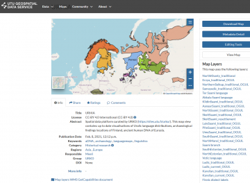
- URHIA map located in the management system and is from here: https://geonode.utu.fi/maps/74/view
- Instructions for browsing URHIA map Information is found from here: https://docs.geonode.org/en/master/usage/managing_maps/map_info.html
It should look as following https://geonode.utu.fi/maps/74 :
- Instructions for browsing Layer information and download is found from here: https://docs.geonode.org/en/master/usage/managing_layers/layer_metadata.html
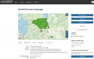
It should look as following example https://geonode.utu.fi/layers/geonode:SouthEstonian
DOWNLOAD LAYER
- Instruction for downloading layer from Layer Page is found from here: https://docs.geonode.org/en/master/usage/managing_layers/layer_download.html
REGISTER AS A NEW USER AND UPLOAD LAYERS
i. Log in
-
- Unregistered users have read-only access to the URHIA map. In order to add layers and share these resources with other users, you need to sign in to the UTU Geospatial Data Service. To take full advantage of all the service features you need an user account (when clicking this phrase the page jumps to the same page Register as a new user – heading). Once you have gone through the prequisities (Want to publish data in URHIA?), please track the following step-by-step instructions.
ii. By default only owners can edit and manage maps and layers, anyone can view and download the layers. To get permission to add data to the URHIA homepage map view, you need to register. Click the Register link and the registration form appears.
![]()
iii. On the form page, fill out the information needed. Enter username and password, and email for verification. 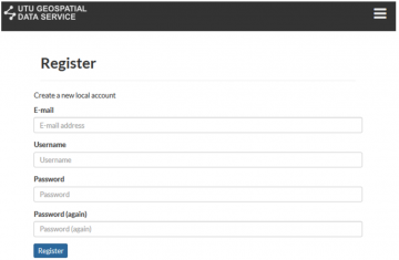
UPLOADING NEW LAYER
- Instructions for Upload Layer is found from here: https://docs.geonode.org/en/master/usage/managing_layers/uploading_layers.html