Datasets
Our research uses various kinds of linguistic, genetic, archaeological and environmental data, but we are building frontends for three new datasets:
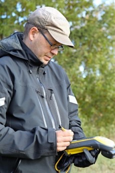
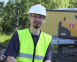
1. The ArGeoPop and Kipot ja Kielet research projects, led by Päivi Onkamo, are digitizing the Ancient Relic Register of Finland. The data includes typological classification of each finding, timing analyses of the findings (if done), coordinates, photos etc. We encourage you to visit the Facebook page of the Kipot ja kielet project!
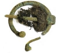
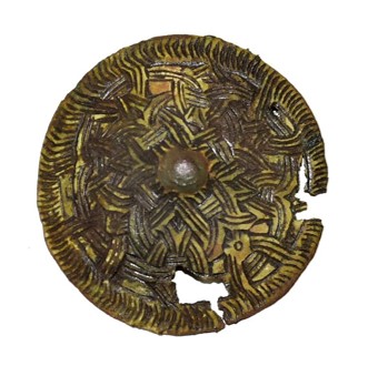
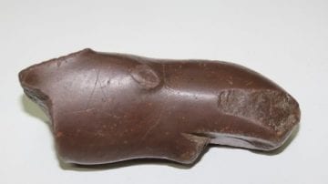
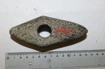
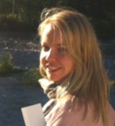
People who have gone through the findings in museums include the archaeological coordinator of Kipot ja Kielet, Petro Pesonen (Helsinki University, bottom left), Ulla Moilanen (University of Turku and Jarkko Saipio (Helsinki University).
2. No consistent typological, grammatical dataset of Uralic languages has existed, although the WALS database covers seven Uralic languages. The BEDLAN research projects (Unni Leino and Outi Vesakoski) began to compile a typological dataset of Uralic Languages already in 2013, based on existing feature lists. The project truly took off during the Kipot ja Kielet project, as a collaborative effort between the University of Tartu (professors Karl Pajusatu, Helle Metslang and Gerson Klumpp) and Uppsala University (professors Rogier Blokland and Michael Dunn). Miina Norvik was hired by Kipot ja Kielet to coordinate data collecting.
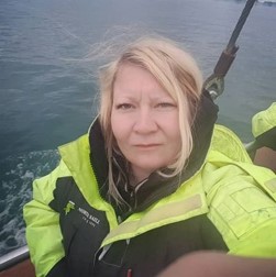
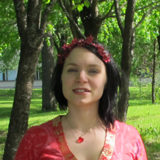
The data consists of two parts: the so-called Grambank feature list (195 features), collected in collaboration with Jena’s Max Planck Institute, and the new UraTyp list (150 features), which emphasize existing differences between Uralic languages. Both datasets cover similar data points, showing whether linguistic feature X is present in language Y or not. The UraTyp data also includes example cases of each typological feature. The dataset is collected using grammar books and linguistic publications, but because these are not available for many Uralic languages (!!), some of the data comes from Uralic language experts. The photo below shows Miina Norvik and Eva Saar collecting Veps dialect data.
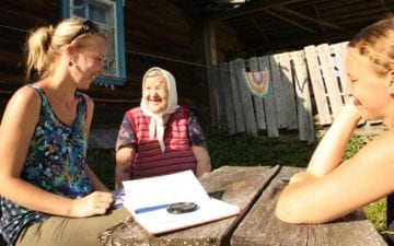
In addition to Norvik (bottom left), Minerva Piha (University of Turku) and Eva Saar (University of Tartu) have also collected the UraTyp data from grammars, linguistic publications and linguistic informants. The GramBank data has been collected by Richard Kowaleck (Stockholm University), using similar methods.
3. No geographical data of the Uralic languages’ speaker areas has existed. Because of this, Timo Rantanen from the BEDLAN research project (department of geography and geology, University of Turku) began compiling map data of the Uralic speaker area. The work was done in collaboration with professor Jussi Ylikoski (University of Oulu). The writing staff of the Oxford Guide to the Uralic Languages, consisting of leading Uralic language experts, have updated the maps to match the current state-of-the-art regarding the speaking areas of both present-day and historical Uralic speakers. In addition to Kone Foundation (which has funded the BEDLAN projects), the map data has also been funded by Suomalais-Ugrilainen Seura (the Finno-Ugric Society), as well as the University of Tromsø.
The multidisciplinary UraHoli team also collected other geographical data of the Uralic area, and is also working on a summary article focusing on the linguistic, cultural, genetic and environmental history of Northwest Eurasia. The map frontend will also include other geographical data besides those related directly to the Uralic speaker area.
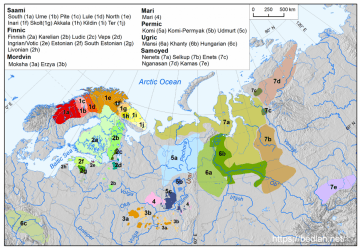
Geographical distribution of Uralic languages at the beginning of the 20th century. Original sources: https://www.bedlan.net/uralic/.
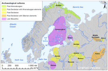
Mesolithic cultures and main lithic traditions. Map: Dmitry Kuznetsov & Timo Rantanen. Original sources: Borodko 2011 (https://национальныйатлас.рф/cd4/territory.html).
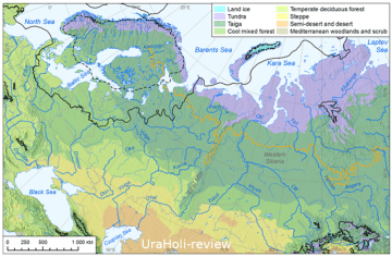
Current vegetation zonation of North-Western Eurasia, the northern limit of barley cultivation and the extent of ice sheet 19, 000 and 13, 000 BC. Map: Timo Rantanen. Original sources: Afonin et al. (2008); Ehlers et al. (2011), Hughes et al. (2015), Binney et al. (2017).
References
Borodko, A.V. (toim.) 2011. National Atlas of Russia vol 4 p 24 <https://национальныйатлас.рф/cd4/territory.html>
Binney, H., Edwards, M., Macias-Fauria, M., Lozhkin, A., Anderson, P., Kaplan, J. O., et al. (2017). Vegetation of Eurasia from the last glacial maximum to present: Key biogeographic patterns. Quaternary Science Reviews 157: 80–97.
Afonin, A.N.; S.L. Greene; N.I. Dzyubenko, A.N. Frolov (eds.). 2008. Interactive Agricultural Ecological Atlas of Russia and Neighboring Countries. Economic Plants and their Diseases, Pests and Weeds[Online]. Available at: http://www.agroatlas.ru. (northern limit of barley cultivation in Russia)
Hughes, A.L.C., Gyllencreutz, R., Lohne, Ø.S., Mangerud, J., Svendsen, J.I. 2015. The last Eurasian Ice Sheets – a chronological database and time-slice reconstruction, DATED-1. Boreas. (ice sheet in 13 000 BP)
Ehlers, J., Gibbard, P.L. & Hughes P.D. (ed.) 2011. Quaternary Glaciations. Extent and Chronology. <https://booksite.elsevier.com/9780444534477/digital_maps.php > (ice sheet, last glacial maximum, 19 000 BP)
Lavento, M. 2001. Textile ceramics in Finland and on the Karelian Isthmus. Nine variations and fugue on a theme of C. F. Meinander, Finnish Antiquarian Society, Helsinki.