Projects
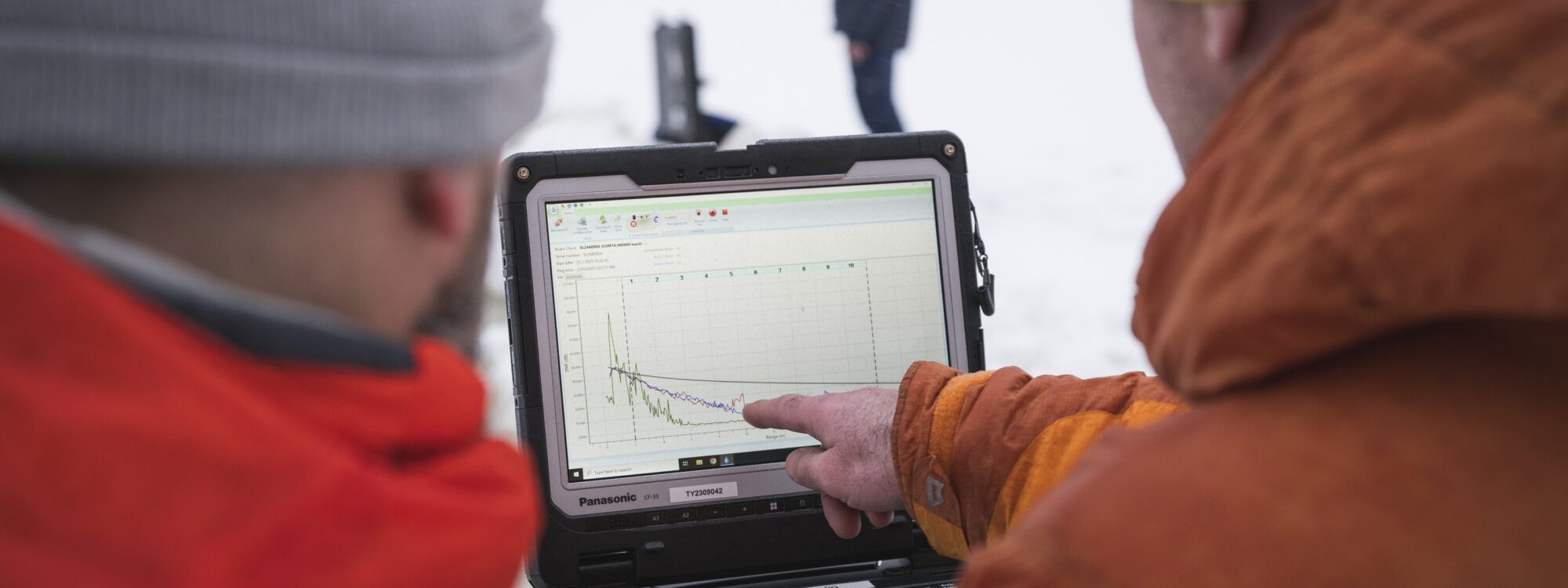
Photo: Ville Kankare
On-going projects
NEMESIS (2026-2028, PI: Elina Kasvi)
Networked Environmental Monitoring and Evaluation System for Intelligent Surveillance (NEMESIS)
NEMESIS research infrastructure (RI) addresses the critical need for comprehensive coastal and marine data collection in the Archipelago sea region and its catchment area. NEMESIS integrates operational and experimental components to study and monitor processes and mechanisms of environmental and security anomalies and long-term changes in the area
Coordinated by Turku University of Applied Sciences, partners: University of Turku, Åbo Akademi
Funder: The Research Council of Finland
Keywords: Archipelago sea; Monitoring; Catchment; Water protection; Water quality
Contact person: Elina Kasvi
Digital Waters Flagship (PI: Petteri Alho)
DIWA flagship is a leading research and innovation ecosystem, bringing research and new innovations to support decision-making and management in the water sector – digitally. We conduct comprehensive and interdisciplinary research within the framework of several universities and research institutions, in both applied and basic research. DIWA Flagship is coordinated by the University of Oulu and has participants from three Finnish universities and three Research institutes. The wide team of experts is building a unique partnership in research and innovation.
Professor Petteri Alho from the Department of Geography and Geology is the Vice-Director of the Digital Waters Flagship and directs the activities at the University of Turku.
Contact: Petteri Alho (mipeal@utu.fi)
Funded by the Research Council of Finland.
Read more about DIWA from digitalwaters.fi
Project partners:
Finnish Environment Institute (SYKE)
Finnish Meteorological Institute (FMI)
National Land Survey of Finland (NLS)
Aalto University (Aalto)
University of Oulu (UO)
AnthroCliMocs (2023-2027, PI: Elina Kasvi)
The accelerating climate change together with the global population growth put major pressure on the fresh waters worldwide. Understanding how rivers respond to environmental factors, such as flooding, climatological changes, or discharge control, and how these affect the long-term riverine changes, is essential in selecting right river and land-use management measures and in climate change adaptation. Recent technological improvements of measurement and analysis methods allow studying river systems with higher detail and extent than has been earlier possible. In AnthroCLiMocs we combine 3D field observations, air-borne data and computational modelling in various spatial and temporal scales to provide new understanding on how climatological and anthropogenic factors affect the meandering river processes and channel changes. The results of this study will enable fostering of more sustainable and nature-based river- and land use management for meandering river basins.
Contact: Elina Kasvi (emkasv@utu.fi)
Funded by the Research Council of Finland.
RESIST - Regions for climate change resilience through Innovation, Science and Technology (2023-2027, PI: Elina Kasvi)
This Horizon Europe project targets strengthening the resilience and accelerating the transformation and adaptive capacity of 12 climate-vulnerable EU regions, one of which is Southwest Finland. The consortium consists of 56 European partners who aim to co-create and validate innovative solutions, raise awareness, leverage citizens’ participation, and promote sustainable exploitation of results towards the markets.
Research at the University of Turku focuses on analyzing the regulations targeting increasing the nature-based solutions (NBS) on water management, their effectiveness in increasing water retention and green space, as well as their implications for financial sustainability and social justice. We will provide basic information of NBS’s via participatory processes emphasizing climate resilience. Our study at Savijoki catchment, in which catchment-scale inclusion of stakeholders will be carried out, focuses on sustainable water management and retention of rural areas using NBS. We will exploit digital catchment modelling to demonstrate the functionality of NBS.
Contact: Elina Kasvi (emkasv@utu.fi)
Project partners from Southwest Finland:
Valonia
Natural Resources Institute Finland (Luke)
Turku University of Applied Sciences (TUAS)
City of Turku
University of Turku
Regional Council of Southwest Finland
Past projects
Maatalouden vesistöpolku (2023-2025, PI: Elina Kasvi)
Hankkeessa toteutetaan kaikille avoin konkreettinen ja informatiivinen Maatalouden vesistöpolku Tuorlan alueelle Kaarinaan. Polun tavoitteena on tarjota vesistötietoutta ja konkreettisia vesienhallinnan esimerkkejä sekä tietoa luonnon monimuotoisuudesta ja sen vaikutuksista ympäristöömme. Alueelle toteutetaan lähekkäin erilaisia vaihtoehtoisia ja myös pienimuotoisempia ja helpommin toteutettavia matalan budjetin vesienhallinnan toimenpiteitä, joiden toiminnallisuutta havainnollistetaan mittauksin. Esiteltävät toimenpiteet edustavat vesienhallinnan ympäristöystävällisiä vaihtoehtoja, jotka hyödyttävät viljelijää taloudellisesti ja luovat paremmat kasvuolosuhteet parantamalla maan kasvukuntoa ja siten sadonmuodostusta. Polku on suunnattu maaseutuyrittäjille, varhaiskasvatukselle, sekä kouluille ja korkeakouluille. Parantunut vesistötietous, sekä ymmärrys erilaisista vesienhallinnan keinoista sekä niiden vaikutuksista Saaristomeren vedenlaatuun, auttaa maaseutuyrittäjiä kestävien ja ravinnevalumia vähentävien vesienhallinnan keinojen valinnassa. Lisäksi tavoitteena on vahvistaa kuluttajien, varhaiskasvatusikäisten lasten, perusopetuksen oppilaiden ja korkeampien koulutusasteiden opiskelijoiden vesistö- ja luontotietoutta.
Polusta toteutetaan virtuaalinen representaatio, joka mahdollistaa puistossa vierailemisen verkon välityksellä ja varmistaa sen valtakunnallisen saavutettavuuden. Virtuaalinen vesistöpolku integroidaan osaksi vesistöpolun internetsivuja. Se toteutetaan mittaamalla alueen maapinnan geometria tarkoin 3D-menetelmin (laserkeilaus, droonit, viistokaikuluotaus), jotka yhdistetään aluetta kuvaavaksi saumattomaksi 3D-pistepilveksi ja kuvamosaiikiksi. Alueesta toteutetaan 3D-malli sekä ennen rakentamisen aloittamista että puiston valmistuttua, jolloin virtuaalinen vesistöpolku mahdollistaa myös alueen tarkastelun ennen ja jälkeen toimenpiteiden rakentamisen. Virtuaalisen mallin rakentamisesta vastaa Turun yliopisto.
Contact: Elina Kasvi (emkasv@utu.fi)
Partnerit:
Ammattiopisto Livia
Turun yliopisto
Valonia
Turun ammattikorkeakoulu
Green-Digi-Basin (2022–2024, PI: Petteri Alho)
In Green-Digi-Basin, we will use multidisciplinary approaches, novel technologies and smart solutions in close collaboration with different stakeholders and end-users to provide crucial information for sustainable and resilient water resource management. The project is strongly connected to the existing competence center a.k.a. HYDRO-RDI-Network. We are aiming to find the most effective green solutions for the boreal-subarctic river basins and improve current calculations for river connectivity, nutrient, and carbon loads to surface water systems from different land use. We further consider land-use scenarios including various types of green solutions (e.g. peatland restoration, wetland, gypsum treatment) for predicting water volume and quality in the river basin scale.
Project partners:
Finnish Environment Institute (SYKE)
National Land Survey of Finland (NLS)
University of Eastern Finland (UEF)
University of Oulu (UO)
Hydro-RDI-Network (2021–2022)
Hydro-RDI-Network is a consortium of research organizations and companies jointly taking an action to boost RDI activities related to hydrology. The aim is to improve and implement river and catchment measurement, as well as mapping and modeling approaches developed in previous research projects.
Hydro-RDI-Network applies a wide variety of methods in the development of service packages in relation to flood risk, dam safety, river habitats, water quality, and sustainable river management.Hydro-RDI-Network receives special funding for RDI partnership networks from the Academy of Finland 2020-2022.
Coordinating partners are the University of Turku/Department of Geography and Geology, the Finnish Environment Institute, the Finnish Geospatial Research Institute (FGI) in the National Land Survey of Finland, the University of Eastern Finland, and the University of Oulu.
UTU researchers in the project:
Petteri Alho, Leader of the Hydro-RDI-Network
Carlos Gonzales Inca, Postdoctoral researcher
Mikel Calle Navarro, Postdoctoral researcher
Linnea Blåfield, Doctoral candidate
Karoliina Lintunen, Doctoral candidate
Project partners:
Finnish Environment Institute (SYKE)
National Land Survey of Finland (NLS)
University of Eastern Finland (UEF)
University of Oulu (UO)
![]()
COMBAT (2015-2021)
COMBAT/Pointcloud (2015-2021)
The project produces information on the use of a three-dimensional measuring technique known as laser scanning, and thereby creates preconditions for the growth of the Finnish 3D industry. Laser scanning rapidly produces a large number of three-dimensional points from the environment, referred to as pointclouds. They serve as a basis for identifying and modelling features. The open data that is produced benefits a wide user base, from individuals to companies and state and local administration.
A pointcloud application is the most important technology for producing 3D maps, models, and virtual reality. Several mobile laser scanners in the air and on the ground create a point cloud ecosystem. The ecosystem supplements information on the environment produced by the Internet of Things and various sensor networks.
Pointcloud project focuses on the utilization of point clouds for 3D modelling and commercial potential in mapping of forests, cities and routes such as roads, power lines and rivers. Laser scanning has already significantly improved forest inventory, among other things.
The project is funded by The Strategic Research Council (SRC) at the Academy of Finland and is carried out by the Finnish Geospatial Research Institute, Aalto University, University of Oulu and University of Turku. The SRC funds high-quality research that has great societal impact. The research seeks to find concrete solutions to grand challenges that require multidisciplinary approaches.
BONUS Basmati (2017–2020)
BONUS BASMATI – Baltic Sea Maritime Spatial Planning for Sustainable Ecosystem Services (2017–2020)
The BONUS BASMATI project focuses on Maritime Spatial Planning (MSP) and marine and coastal ecosystem services. It analyses governance systems in the Baltic Sea region in order to develop a transnational model for MSP. A major outcome will be a MSP tool called Baltic Explorer. It is a spatial decision-support system designed to support the MSP process around the Baltic Sea.
The Baltic Explorer facilitates broad access to information. It helps planners and stakeholders to overcome the challenges of MSP, such as transboundary and cross-border planning and comprehensive mapping and management of ecosystem services. The tool will be developed with the help of its end-users and it will be tested in three BONUS BASMATI case studies. Cross-border collaboration and stakeholder involvement play a crucial role in the project.
Project website: www.bonusbasmati.eu.
UTU researchers in the project:
Harri Tolvanen, Leader of the work package 7, Department of Geography and Geology
Hanna Luhtala, Postdoctoral researcher, Department of Geography and Geology
Anne Erkkilä-Välimäki, Senior Adviser, Centre for Maritime Studies (CMS)
Project partners:
Aalborg University (AAU), Denmark; Aarhus University (AU), Denmark; Nordregio, Sweden; Finnish Geospatial Research Institute (FGI), Finland; University of Turku (UTU), Finland; Latvian Institute of Aquatic Ecology (LIAE), Latvia; Leibniz Institute for Baltic Sea Research Warnemünde (IOW), Germany.
Funding:
BONUS BASMATI project has received funding from BONUS (Art 185), funded jointly by the EU and Innovation Fund Denmark, Swedish Research Council Formas, Academy of Finland, Latvian Ministry of Education and Science, and Forschungszentrum Jülich GmbH (Germany).
Infrariver (2016–2019)
This 3-years postdoctoral project was funded by the Academy of Finland and run by PhD Elina Kasvi. The project focuses on human and climate impacts on cold regions rivers. Both detailed short term investigations, and larger spatial scale studies of future conditions have been realized. Methodological approaches include, for example, hydrological and hydraulic modelling, close range remote sensing and archival imaginary.
Plan4Blue (2016–2019)
Plan4Blue – Maritime Spatial Planning for Sustainable Blue Economies (2016–2019)
The project supports the growth of the marine and maritime sectors in a way that emphasizes the need to find a balance between economic, social and environmental goals.
Plan4Blue brings together the key blue growth and maritime spatial planning actors from Estonia and Finland to identify pathways to the sustainable use of the sea areas and resources. The project activities focus on Estonian and Finnish sea areas in the Gulf of Finland and the Archipelago Sea areas. Planning and management of these areas requires collaboration between various stakeholders and authorities in different countries, as many of the economic activities in the area and also their impacts cross borders. For this purpose, the project develops cross-border capacity in maritime spatial planning.
Project information: www.syke.fi/projects/plan4blue, co-funded by the EU European Regional Development Fund (Interreg) and project partner organisations*. The project is carried out in the Gulf of Finland in northern Europe, involving Finland and Estonia (territorial waters and exclusive economic zones of Finland and Estonia).
Project partners: Finnish Environment Institute SYKE, University of Tartu, University of Turku, Helsinki-Uusimaa Regional Council, Regional Council of Southwest Finland, Baltic Environmental Forum Estonia.
![]()
Projects before 2016
- AquaLight, 2011–2015, funded by Academy of Finland
- Coastal Internet services 2002–2004, funded by Maj and Tor Nessling Foundation
- Coaster, 2007–2009, funded by Academy of Finland
- Coastra, 2002–2004, funded by Maj and Tor Nessling Foundation
- DeepSURNA, 2011, funded by SINTEF Energi AS , Norway
- Envifacilitate, 2004–2006, funded by EU Life
- Extreflood I/II, 2003–2009, funded by the Ministry of Agriculture and Forestry and the Ministry of Environment
-
FLOODAWARE, 2009–2011, funded by the Maj and Tor Nessling Foundation
-
FINFLOODS, 2007–2010, funded by the Academy of Finland
- FINMARINET, 2009–2012, funded by EU Life+
- GIFLOOD, 2008–2012, funded by Finnish Funding Agency for Technology and Innovation (Tekes), Water programme
- LuHaGeoIT, 2012–2014, funded by funded by the Ministry of Agriculture and Forestry
- Meriluonto, 2003–2006, funded by Ministry of Environment
- RivChange, 2010–2015, funded by Academy of Finland
- TULeVAT, 2007-2010, funded by the Academy of Finland
- ValoMeri, 2011–2013, funded by Kone Foundation
- VELMU, 2004–2014, funded by Ministry of Environment