Research themes
Photo: Ville Kankare
Currently our research topics include themes listed below.
Climate change and water protection
We study various effects of changing hydro-climatological conditions on watersheds by combining climate change scenarios with hydrological, watershed, and hydraulic models. We analyse the climate change effects on, for example, river discharges, erosion, floods and droughts, and nutrient loads. We also study nature-based solutions and their potential in water protection and climate change adaptation.
Flood hazards and risks
Damages caused by floods have grown more and more common and serious on a global scale. Methods for flood risk mapping were developed together with the Finnish Environment Institute (SYKE) with the objective of creating a system by which the measures required by the European Union Directive on the Assessment and Management of Flood Risks can be cost-efficiently implemented in the whole of Finland.
Marine geoinformatics in the Baltic Sea
The Baltic Sea is a complex and vulnerable environment, which is challenging to study and manage. The methods of geoinformatics are applied in marine research in many contexts, but the work involves several issues that separate marine geoinformatics from land area geoinformatics. Main differences are related to the vertical dimension from the seafloor to the water surface, and the dynamical nature of the water element. This makes marine geoinformatics a very interesting topic of research for the group of geographers.
Maritime spatial planning and coastal zone management
The research group currently participates in two EU funded development projects, which support the ongoing maritime spatial planning (MSP) processes in the Baltic Sea countries. MSP is promoted by the EU, which established a directive in 2014 to set requirements for the Member States to finalize theis maritime spatial plans by 2021. The MSP process is inherently a complicated social and political process, which demands local, regional and international cooperation between administrative units and stakeholders. Research projects aim at developing methods and practices to support and improve the planning processes in the Baltic Sea countries.
Megaflood studies
We have employed hydraulic modelling to understand the past paleoflow conditions for different scenarios of draining Glacial Lake Missoula (GLM) at its highest stands in Montana, the USA. Furthermore, our group has employed hydraulic modelling to determine the potential and limitations of one-dimensional hydraulic modelling for glacial outburst flood (jökulhlaup) simulations in NE Iceland. Reconstruction of the largest Holocene jökulhlaup along Jökulsá á Fjöllum, NE Iceland has also been carried out.
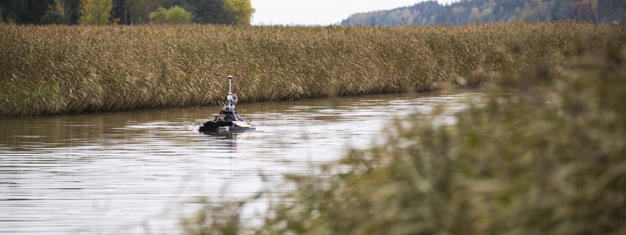
Remote sensing & laser scanning in fluvial studies
We use several close-range remote sensing techniques to study riverine processes.
Laser scanning has enabled highly accurate data gathering with increased horizontal and vertical precision and better availability of detailed spatial data. For example, airborne laser scanning (ALS), ALS systems for bathymetric measurements, fixed-position terrestrial laser scanning (TLS) and mobile laser scanning (MLS), such as boat- and cart-based mapping systems (BoMMS/CartMMS), have revealed new potential in fluvial research.
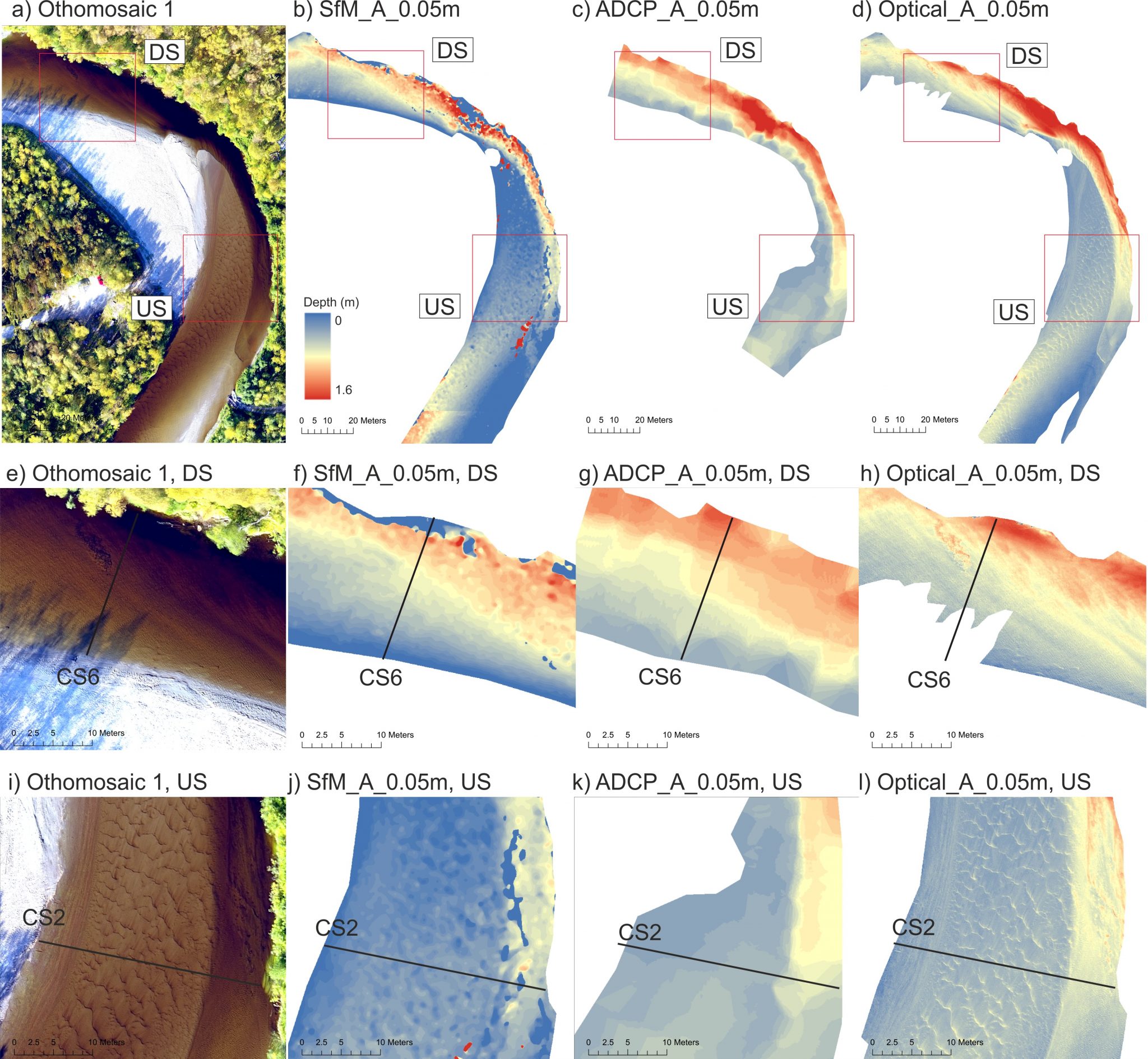
Aerial photography based bathymetry modelling allows us to create depth models at high spatial resolution, based on the connection between water depth and measured reflectance. Several models have been tested and developed on the Tana river in Lapland.
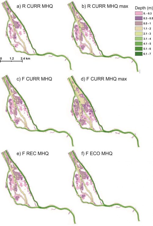
River dynamics
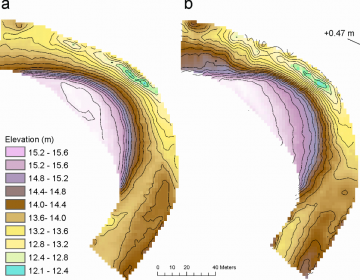 the determination of past, present and future river dynamics. 1D-, 2D- and 3D-modelling approaches can also be used for the determination of flow characteristics, such as flow velocity, bed shear stress and stream power and also flood inundation areas. Modelling results can be applied e.g. in flood risk management, river rehabilitation and river basin management plans.
Spatio-temporal dynamics of coastal water properties
Coasts are characteristically heterogeneous hydrological systems, where river runoff and pelagic water mix. We have studied the wide coastal archipelago of SW Finland to understand the complex patterns of horizontal and vertical mixing, and the dynamics of river-borne water and substance dispersion through the coastal area. Many processes that affect the water undergo seasonal development cycles, but the Baltic Sea coasts are also influenced by irregular flow events driven by weather variability.
Underwater light dynamics
In relation to research on coastal water properties, our group has recently focused on the studies of underwater light. We have conducted systematic measurements of the visible spectrum of solar radiation in water. Through these in situ measurements, we have assessed the spatio-temporal variations in the thickness of the illuminated surface water layer defined by the euphotic depth. In addition, we have studied water transparency with turbidity and Secchi disc measurements, which can be used as proxies for underwater light availability.