River dynamics
Our research group focuses on various river related processes at several study reaches and estuaries. We utilized both state-of-the-art close-range remote sensing applications and traditional measurement methodologies hand in hand. Our research interest is focused on flow variations, channel morphology, meander evolution, sediment transport and development of measurement technologies etc. We study both open water and ice-cover conditions together with break-up of ice.
Modelling is one of our main approaches along with intensive field measurements. Hydraulic modelling significantly improves the spatiotemporal resolution of research interest. High quality data combined with modern modelling technology help us to understand various river processes more detailed.
Research examples
Kasvi, E., Laamanen, L., Lotsari, E. and Alho, P. (2017). Flow Patterns and Morphological Changes in a Sandy Meander Bend during a Flood—Spatially and Temporally Intensive ADCP Measurement Approach. Water, 9(2), p.106. DOI.
Abstract:
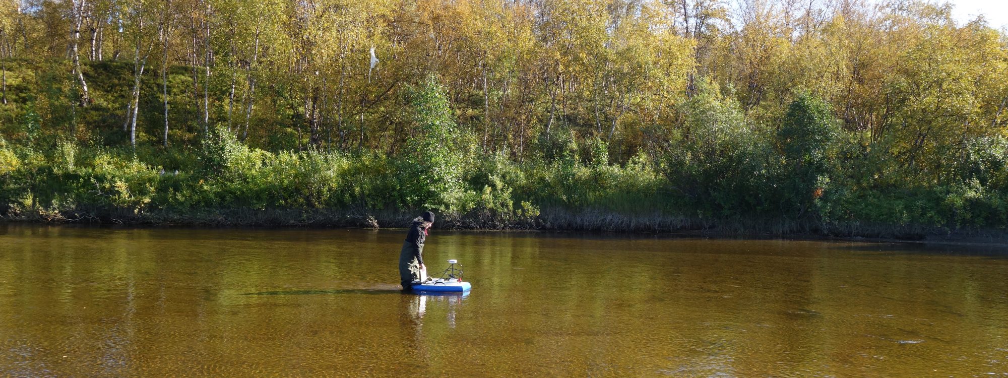
The fluvio-geomorphological processes in meander bends are spatially uneven in distribution. Typically, higher velocities and erosion take place near the outer bank beyond the bend apex, while the inner bend point bar grows laterally towards the outer bank, increasing the bend amplitude. These dynamics maintain the meander evolution. Even though this development is found in meandering rivers independent of soil or environmental characteristics, each river still seems to behave unpredictably. The special mechanisms that determine the rate and occasion of morphological changes remain unclear. The aim of this study is to offer new insights regarding flow-induced morphological changes in meander using a novel study approach. We focused on short-term and small-spatial-scale changes by conducting a spatially and temporally (daily) intensive survey during a flood (a period of nine days) with an ADCP attached to a remotely controlled mini-boat. Based on our analysis, the flood duration and the rate of discharge increase and decrease seems to play key roles in determining channel changes by controlling the flow velocities and depth and the backwater effect may have notable influence on the morphological processes. We discuss themes such as the interaction of inner and outer bend processes and the longer-term development of meander bends.
Calle, M., Alho, P. and Benito, G. (2018). Monitoring ephemeral river changes during floods with SfM photogrammetry. Journal of Iberian Geology, 44(3), pp.355-373. DOI.
Abstract:
Monitoring detailed topographic changes in rivers is an essential tool for understanding the morpho-sedimentary behavior of rivers. However, as the resolution of topographic reconstruction techniques improves, survey costs and the time consumed increase. In this paper, the emerging Structure from Motion Multi-View Stereo (SfM-MVS), a high resolution but low cost technique, is scrutinized to assess whether it constitutes a viable option for ‘change detection’ in ephemeral rivers. To that end, three photogrammetric flights were carried out to reconstruct the subsequent digital elevation models (DEMs) and quantify fluvial change caused by two floods in 2015 along a 6.5 km reach in an ephemeral gravel-bed river (Rambla de la Viuda; eastern Spain). The application of SfM-MVS resulted in a maximum point cloud density of 1295.4 pts/m2 and a DEM resolution of 3.11 cm/pix. Individual flights registered errors of 0.101, 0.171 and 0.083 m. Level of detection (LoD) of DEMs of difference (DoDs), i.e. topographic change detection, resulted in 0.198 and 0.190 between the first and second, and second and third flights respectively. Orthomosaics were also successfully created at a maximum resolution of 2.50 cm/pix. Analysis of the best configuration of SfM-MVS for ephemeral river monitoring indicated that a high overlap of photographs and, therefore, a large number of projections were critical for an efficient workflow and a high-quality model. To ensure model quality and survey efficiency, the following configuration is recommended: (1) overlap index of more than 20 projections, (2) flight distribution at two heights, and (3) the use of ground control points. SfM-MVS topographies and DoDs showed a discontinuous pattern represented by a succession of erosive-depositional sequences. Evolution of one of these sequences has been studied in detail and the legacy of a past mining pit was pointed out to be the principal driver for this morphosedimentary pattern. Change detection quantified a net erosion of (−)3118 m3 for Flood #1 and a net deposition of (+)787 m3 for Flood #2, at a 95% confidence. Knickpoint retreat, riverbed lowering and bank erosion were identified as the principal sources of sediment. Analyzing separately each flood highlighted that the mobilization of sediments was not proportional to peak discharges (98 and 80 m3/s, respectively). Interpretation of this behavior was hypothesized to be produced by the difference in total water volume (32.5 and 7.1 hm3), longer discharge period (24 and 11 days), different entrainment thresholds of each flood, or a clockwise hysteresis effect in the sediment transport, probably due to varying sediment availability. Thus, it was concluded that SfM-MVS worked especially well for change detection in ephemeral rivers and served as a basis for understanding morphological river patterns associated to floods and human impacts.
Lotsari, E., Calle, M., Benito, G., Kukko, A., Kaartinen, H., Hyyppä, J., Hyyppä, H. and Alho, P. (2018). Topographical change caused by moderate and small floods in a gravel bed ephemeral river – a depth-averaged morphodynamic simulation approach. Earth Surface Dynamics, 6(1), pp.163-185. DOI.
Abstract:
In ephemeral rivers, channel morphology represents a snapshot at the end of a succession of geomorphic changes caused by floods. In most cases, the channel shape and bedform migration during different phases of a flood hydrograph cannot be identified from field evidence. This paper analyses the timing of riverbed erosion and deposition of a gravel bed ephemeral river channel (Rambla de la Viuda, Spain) during consecutive and moderate- (March 2013) and low-magnitude (May 2013) discharge events, by applying a morphodynamic model (Delft3D) calibrated with pre- and post-event surveys by RTK-GPS points and mobile laser scanning. The study reach is mainly depositional and all bedload sediment supplied from adjacent upstream areas is trapped in the study segment forming gravel lobes. Therefore, estimates of total bedload sediment mass balance can be obtained from pre- and post-field survey for each flood event. The spatially varying grain size data and transport equations were the most important factors for model calibration, in addition to flow discharge. The channel acted as a braided channel during the lower flows of the two discharge events, but when bars were submerged in the high discharges of May 2013, the high fluid forces followed a meandering river planform. The model results showed that erosion and deposition were in total greater during the long-lasting receding phase than during the rising phase of the flood hydrographs. In the case of the moderate-magnitude discharge event, deposition and erosion peaks were predicted to occur at the beginning of the hydrograph, whereas deposition dominated throughout the event. Conversely, the low-magnitude discharge event only experienced the peak of channel changes after the discharge peak. Thus, both type of discharge events highlight the importance of receding phase for this type of gravel bed ephemeral river channel.
Vesakoski, J., Nylén, T., Arheimer, B., Gustafsson, D., Isberg, K., Holopainen, M., Hyyppä, J. and Alho, P. (2017). Arctic Mackenzie Delta channel planform evolution during 1983-2013 utilising Landsat data and hydrological time series. Hydrological Processes, 31(22), pp.3979-3995. DOI.
Abstract:
Arctic deltas, such as the Mackenzie Delta, are expected to face major climate change and increased human influence in the near future. Deltas are characterised by highly dynamic fluvial processes, and changing climate will cause considerable evolution of the riverine environment. The changes are difficult to predict with existing knowledge and data. This study quantified channel planform change of the Mackenzie Delta (1983–2013), analysing its temporal and spatial patterns. We addressed the main obstacle of research on large remote areas, the lack of data, by developing a unique work flow that utilised Landsat satellite imagery, hydrological time series, remote sensing‐based change analysis, and automatic vectorisation of channels. Our results indicate that the Mackenzie Delta experienced constant evolution but at a highly varying rate over the 30 years. The study demonstrates that the magnitude and duration of flood peaks and the presence of spring ice breakup floods determine the rate of Arctic delta planform change. Changing winter conditions and spring flood magnitudes may therefore affect the stability of Arctic deltas. However, no clear trends towards decreased recurrence or magnitude of spring floods or increased instability of the delta plain have yet been observed in the Mackenzie Delta. The delta plain was most dynamic at the beginning and at the end of the examined period, corresponding to intense flooding, whereas the rates of change were subtle during the low‐flood period 1994–2007. The largest changes have occurred along the wide Middle Channel and in the outermost delta. Relative to their size, however, smaller meandering channels have been highly dynamic. Hotspots of change in the delta plain are located in anastomosing and braiding channel segments and, at the local scale, in point bars and cut‐banks along meandering channels. Our study describes how Landsat satellite data can be utilised for advancing fluvial geomorphological research in remote areas. However, cloudiness in the delta restricts production of dense time series with simultaneous coverage of the whole area and requires manual preprocessing.
Kasvi, E., Hooke, J., Kurkela, M., Vaaja, M., Virtanen, J., Hyyppä, H. and Alho, P. (2017). Modern empirical and modelling study approaches in fluvial geomorphology to elucidate sub-bend-scale meander dynamics. Progress in Physical Geography: Earth and Environment, 41(5), pp. 533-569. DOI.
Abstract:
Major developments in theory and modelling techniques have taken place within the past couple of decades in the field of the fluvial geomorphology. In this review, we examine the state-of-the-art empirical and modelling approaches and discuss their potential benefits and shortcomings in deepening understanding of the sub-bend-scale fluvial geomorphology of meander bends. Meandering rivers represent very complex 3D flow and sedimentary processes. We focus on high-resolution techniques which have improved the spatial and temporal resolution of the data and thereby enabled investigation of processes, which have been thus far beyond the capacity of the measurement techniques. This review covers the measurement techniques applied in the field and in laboratory circumstances as well as the close-range remote sensing techniques and computational approaches. We discuss the key research questions in fluvial geomorphology of meander bends and demonstrate how the contemporary approaches have been and could be applied to solve these questions.